Dinosaur National Monument
Dinosaur National Monument is a 240,000-acre wilderness in northeastern Utah with very limited access via paved roads. There are many miles of dirt roads, which are not friendly to passenger cars.
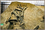
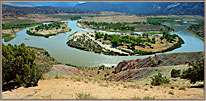
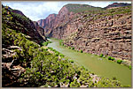
The Green and Yampa Rivers wind through the Monument, carving immense canyons which are mainly seen from high overlooks or via certain access points used for launching river rafts. Rafting is a wonderful way to access parts of the Monument which have no road access.
The easiest way to visualize the public access to the park is to think of it as three separate park areas.
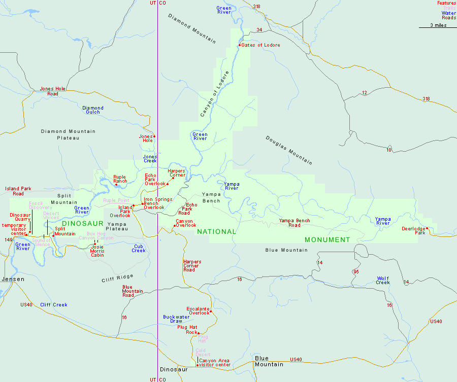
One is the Utah entrance and visitor center near Jensen. Here we can drive to the Dinosaur Quarry, Split Mountain and Island Park (via dirt road).
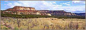
A second area of the park is called Canyon Country, and is accessed from another entrance with a visitor center near Dinosaur, Colorado. From the visitor center we can drive North via Harper’s Corner Road. This 38-mile paved road passes Plug Hat Butte, Echo Park and a number of other overlooks, culminating in the majestic Harper’s Corner overlook (one of the grandest views of the southwest).
Dinosaur National Monument ~ Vernal, Utah
Dinosaur Quarry
Split Mountain Island Park Harper's Corner Echo Park
Yampa Bench Road The Gates of Lodore Carl Roessler
P.O. Box 33668
Las Vegas, NV 89133
voice: 702.562.0226
Return to Home Page E-mail Carl Roessler: divxprt@cox.net Photos All material in this Web Site is Copyright © Carl Roessler 2025 - All rights reserved.
Maintenance by Patricia of Visual Ad Worx
Modified 02.26.25