Flathead Lake And The Polson Bridge Near Kalispell, Montana
Montana Summer 2016
Aerial Photography Using Drones
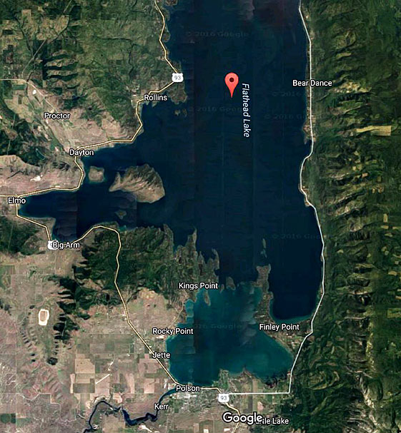
Flathead Lake is created by the buildup behind the Kerr Dam (shown at the bottom of the map--you can even make out the dam).
This lake is immense, showing the massive amount of water coming down the Flathead River.
I took my first high overview flight between Elmo and King's Point, looking northward out at Wild Horse Island (not labeled in satellite image).
Later I added Polson's unusual bridge, and the celebration after a marathon run. As I drove from Polson out to Kerr Dam, I could see the competitors struggling, some even walking, but all determined to get to the finish line. So, when I heard their loud celebration going on, I flew over to see them from a respectful distance.
On a second I drove down the East side of the lake, launching at various spots in the morning light. Later I stopped at two State Parks along the West shore, with spectacular results. I love chasing those fast boats!
On the late-Summer day I drove down the western side to Kerr Dam there were boatloads of people enjoying huge runs on very calm water. All this reminded me that when I came up one year to visit Glacier National Park, the main road didn’t get cleared of snow until July, and closed again in mid-September.
These warm summer days are very precious here…
Carl Roessler
P.O. Box 33668
Las Vegas, NV 89133
voice: 702.562.0226
| Return to Home Page | E-mail Carl Roessler: divxprt@cox.net | Photos |
|---|
Maintenance by Patricia of Visual Ad Worx
Modified 11.08.24