
8 Kodachrome Basin State Park
Central Utah Summer 2015An earlier Expedition in 2010!
Aerial Photography Using Drones
This colorful park lies East of Bryce Canyon, on the Cottonwood Canyon Road. It was first revealed to readers of National Geographic Magazine in 1949 as a result of an expedition by the Society. An opening paragraph in the Wikipedia entry (below) gives the most accepted explanation for the many sandstone towers seen in the park.
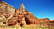
Differing geological explanations of the features in the park Kodachrome Basin State Park exist. One explanation is that the area was once similar to Yellowstone National Park with hot springs and geysers, which eventually filled up with sediment and solidified. Through time, the Entrada sandstone surrounding the solidified geysers eroded, leaving large sand pipes. Sixty-seven sand pipes ranging from two to 52 meters have been identified in the park.[4]
For our purposes, Kodachrome is a friendly place to fly the drones, and two of my three days in the park had brilliant sunshine under clear skies. A third day has heavy haze and scattered, ineffective sunshine.
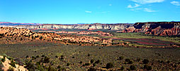
The park is an actual basin, ringed by a high white stone cliff. The sandpipes are scattered all through the basin.
 |
|
 |
|
| ; | |
Carl Roessler
P.O. Box 33668
Las Vegas, NV 89133
voice: 702.562.0226
fax: 702.562.0227
| Return to Home Page | E-mail Carl Roessler: divxprt@cox.net | Photos |
|---|
All material in this Web Site is Copyright © Carl Roessler
2023 - All rights reserved.
Maintenance by Patricia
of Visual Ad Worx
Modified 11.08.23