Prescott December 2017

An enjoyable break from cold, windy days in Vegas. The wind was howling all the way to just outside Prescott, but it died down when I needed it to and I was able to fly at Watson Lake.

As a side note, a local man told me that both Watson Lake and its nearby companion, Willow Lake, were sewer ponds for the town. They were later dammed when the city fathers built treatment plants. That turned the sewer ponds into these pleasant recreation sites.

The weather has held since I arrived, though the third day was a bit cold. With the calm days, I covered Watson, Willow, Lynx and Goldwater Lakes. They are all on the outskirts of Prescott Valley. While small, the lakes are well developed and wonderful as subjects for aerial photography.

Everything can't always be perfect, however. After flying the lakes, I took a day to go 40 miles East to the Verde River Valley. On the radio, I heard that this part of Arizona just had its first day with any rainfall in more than 134 days. That is the second-longest dry spell in recorded history.

Alas, that made the Verde River rather unimpressive at the towns of Clarkdale and Cottonwood. So, I went into Clarkdale and took a couple of shots of the Verde Valley River Railroad, a seasonal sightseeing train my brother and his wife described to me from their visit years ago.

For some extra excitement, the winding, rather wild road through the mountain town of Jerome leads over the range between the Verde River Valley and Prescott Valley. I have rarely seen so many hairpin curves in such rapid succession. Don't drive this road in the dark...

1 Watson Lake

2 Willow Lake

3 Lynx Lake

4 Goldwater Lakes

5 Sheep Bridge

1 Watson Lake December 2017

2 Willow Lake December 2017

3 Lynx Lake December 2017

4 Goldwater Lake December 2017

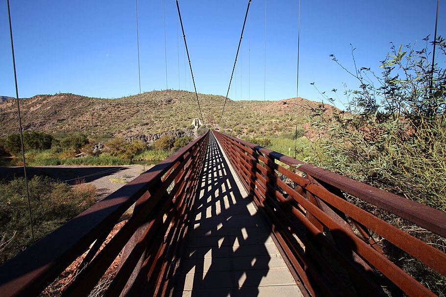
5 Sheep Bridge December 2017

The Sheep Bridge in Arizona

This bridge was built to get large herds of sheep across the Verde River. Here is a bit of the colorful history!

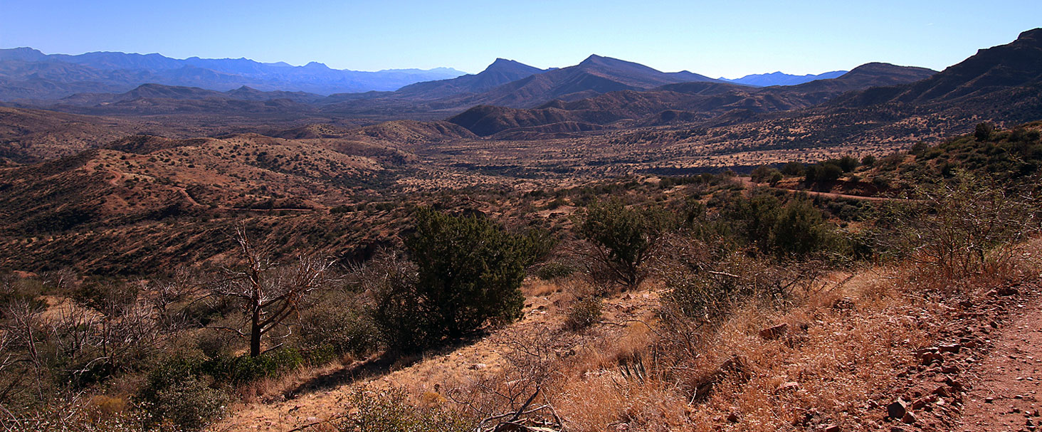
It takes a 40 mile drive on the punishing and dangerous Bloody Basin Road to reach the bridge site. The first picture shows huge Saguaro cacti below the first mountain range you must cross. Then, Picture 1 shows the second mountain range and a broad valley you have to endure, replete with steep hills, sheer cliffs and hairpin curves.

In the morning, going East with the Sun in your eyes, this horrendous road can be a death trap.

Temporarily blinded (as I was many times early this morning), I cut a hairpin turn too closely.

My left rear wheel started to slide as the edge of the roadbed crumbled.

I quickly hit the gas for some acceleration and thank my guardian angels that the tire tread grabbed. If it hadn't, I would have plunged down into a steep ravine with huge boulders at the bottom.

I was lucky to get out of that moment alive. I then noticed that some of the many other hairpin turns were being undermined by snow melt water from last Winter flowing off the mountains. Road crews had recently repaired them with fresh asphalt. Not the one I hit, however...
1 Tall Saguaro Cactus Below The First Mountain Range We Must Cross 2 Yes You Have To Drive Past Those Higher Peaks
4 Looking West On Sheep Bridge
5 Looking Eastward Off Sheep Bridge
Return to Home Page E-mail Carl Roessler: divxprt@cox.net Photos

All material in this Web Site is Copyright © Carl Roessler 2023 - All rights reserved.
Maintenance by Patricia of Visual Ad Worx
Modified 11.06.23