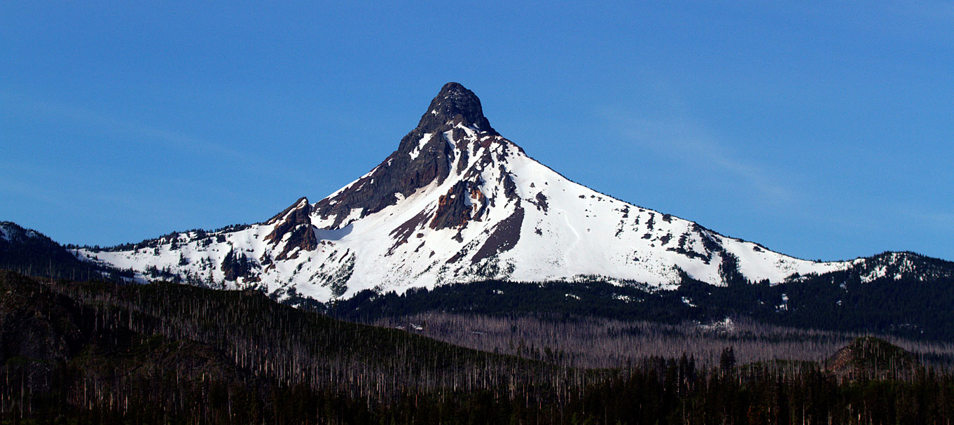
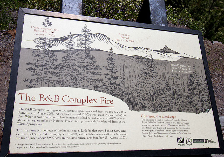
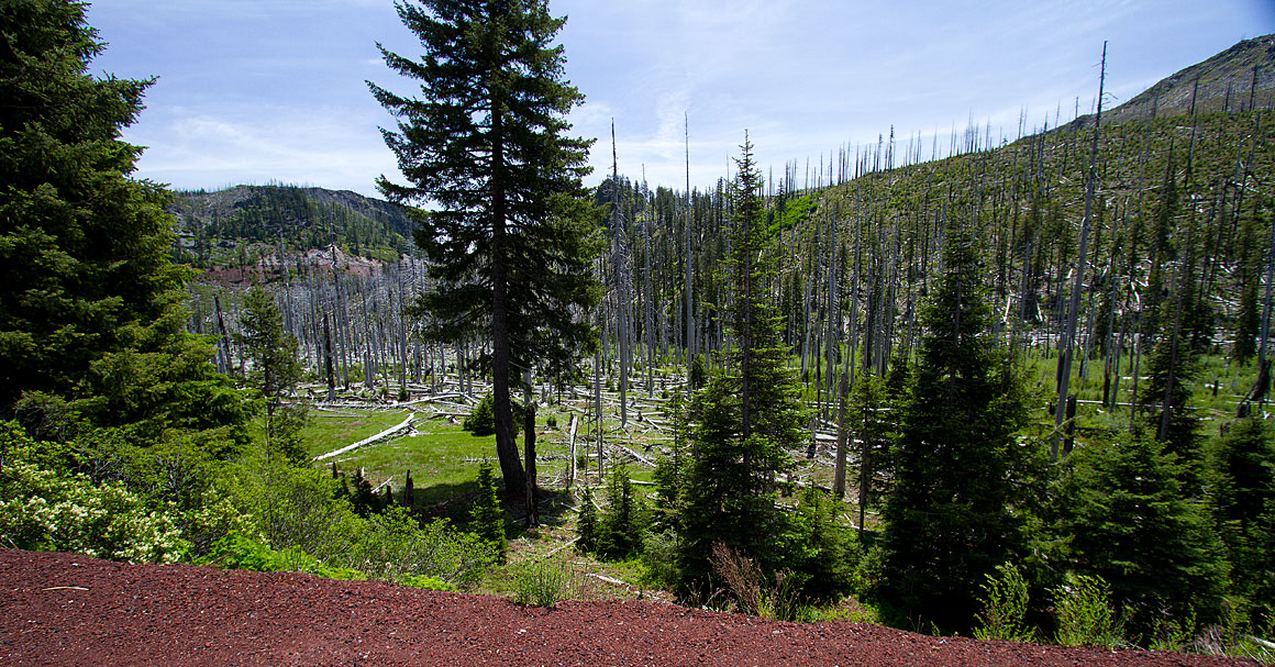
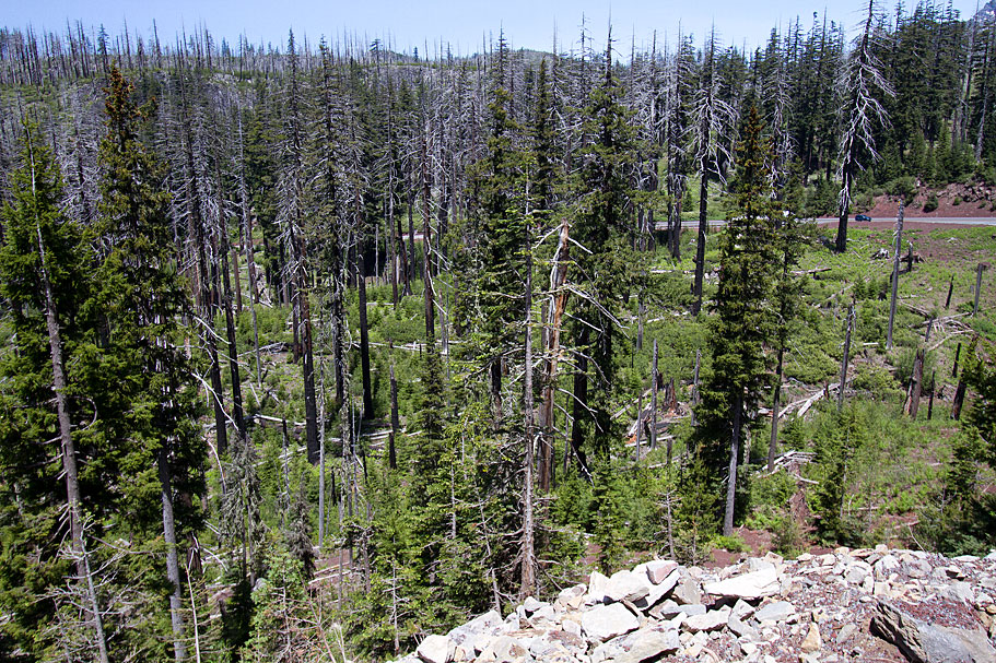
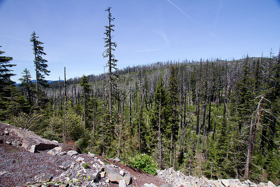
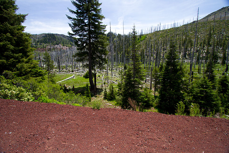
There were several places where a high overlook enabled views of sites where immense fires had burned. While fire is natural in these forests (usually started by lightning), the resulting landscape is sobering. Thousands of trees are denuded and scorched.
These two lakes on the highway to the McKenzie river beyond the town of Sisters was one such viewpoint. My launch was from the Mount Washington overlook. The two lakes were 350 feet below the observation point.
|
|
|
|
|
|
|
|
Big Lake
This remote gem is even closer to Mount Washington than Suttle and Blue Lakes. It, too has had its forest scorched by wildfires, but the placid lake and the towering mountain are very much worth the drive.
|
|
|
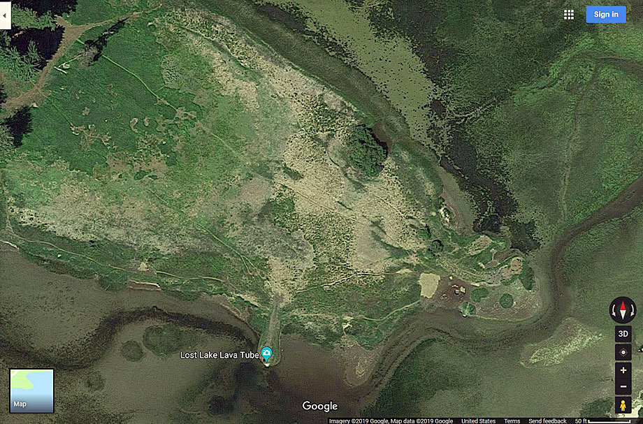
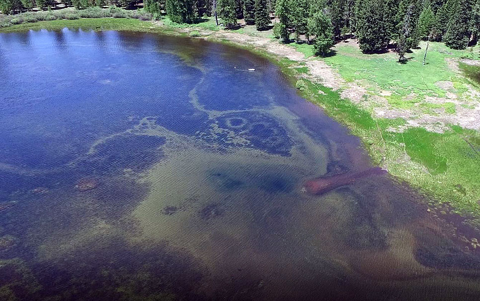
Lost Lake
This lake is a geological oddity, explained in this article and video!
As you see, the lake is already very shallow by June, and the pathway visitors use to walk out to the main lava tube is quite apparent.
|
|
|
|
|
|
|
The Tamolitch Blue Pool
The Blue Pool is a bit of a challenge for the drone. It is 3,250 feet out, beyond a substantial and in a river gorge. That resulted in briefly losing contact with the drone when I had it descending to get closer to the Pool.
Rather than risk losing the drone and having to hike out there and swim for it, I gained altitude, re-established control and observed the stunning blue water from a safe altitude.
|
|
|
|
Cougar Dam And Reservoir
Cougar is another of several truly massive dams in the region around Bend. You can see where the cliffs have been quarried to get at least some of the colossal amount of stone required to build it.
Not five miles away is another slightly smaller dam which creates the Blue River Reservoir.
|
|
|
| |
Blue River Reservoir
This is another good-sized dam on the Blue River, nestled in a bucolic valley just above the town of Blue river. It was surprising, given the good weather during much of my trip, that there weren’t more boaters and fishermen on these lakes. Perhaps the season is more in July and August.
For my purposes, of course, the lack of other people was a boon since the drone’s noise couldn’t disturb anyone who wasn’t there!
|
|
|
|
|
|
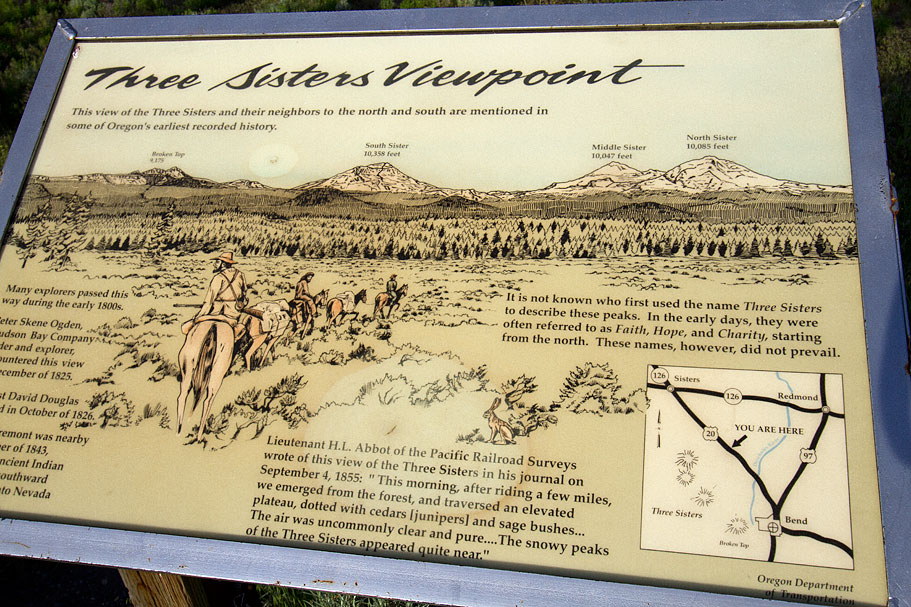
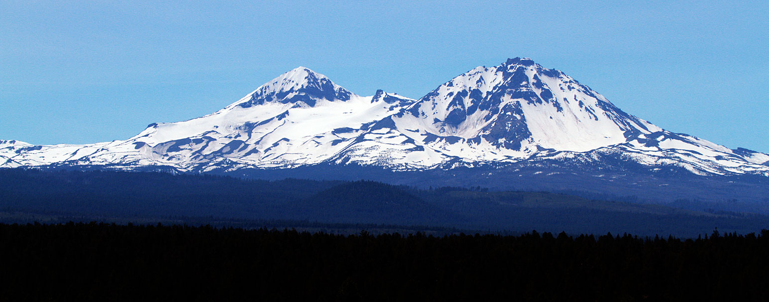
Sisters Overlook And Wildfire Sites
Several miles outside Bend on the way to sisters is a site with a full frontal view of the Sisters volcanoes. There are three, the these two normally get all the attention as they are very close to the town of Sisters.
Following the highway beyond Sisters, there were several areas where wildfires had burned right up to the edge of the highway.
|
|
|
|
|
|
|