Moab, Utah
After a rewarding year of trips to California (twice), Colorado, New Mexico, Arizona and Utah, I decided to take one last short trip to one of my favorite photographic places—Moab, in eastern Utah.
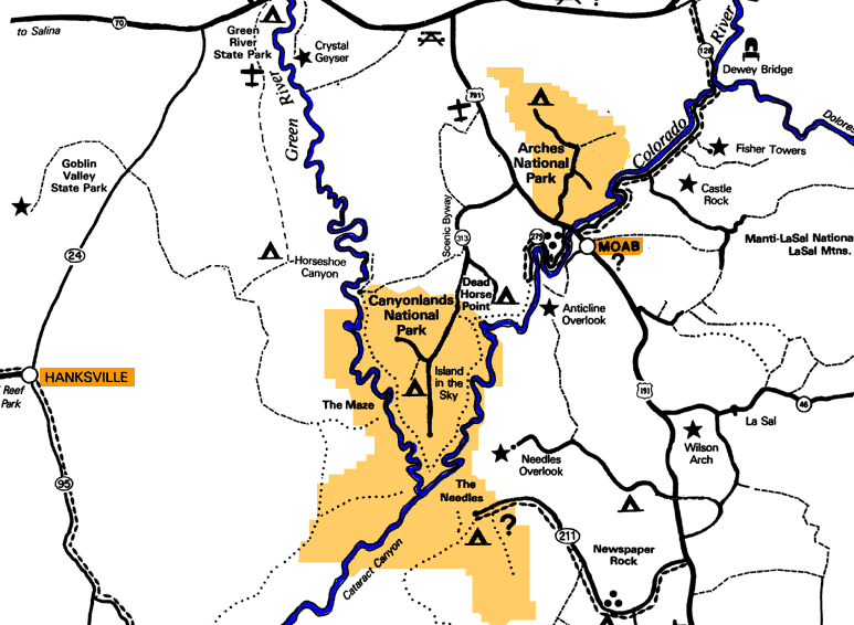
Moab is also hospitable for the Phantom drone, with the Colorado River only 4,100 feet above sea level. The high buttes are usually not much higher than 6,000 feet. Also, despite the National Park Service outlawing drones in nearby national parks such as Arches and Canyonlands, the Colorado River valley running through Moab is a spectacular and legal place to do flights.
This gallery celebrates the five days of spectacular weather I enjoyed, and the variety of wonders outside the national parks that going to Moab provides.
Carl Roessler
P.O. Box 33668
Las Vegas, NV 89133
voice: 702.562.0226
Return to Home Page E-mail Carl Roessler: divxprt@cox.net Photos All material in this Web Site is Copyright © Carl Roessler 2025 - All rights reserved.
Maintenance by Patricia of Visual Ad Worx
Modified 02.20.25