Carl's
Gallery of
National Parks
Carl's |
|
National Parks |
Arizona |
California |
California's East Slope |
Colorado |
Idaho |
Montana |
Nevada |
New Mexico |
Utah |
Canadian Rockies West |
Canadian Rockies East |
|
Using Drones for Aerial Photography |
||
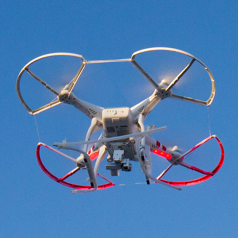 |
Please also visit our drone galleries at |
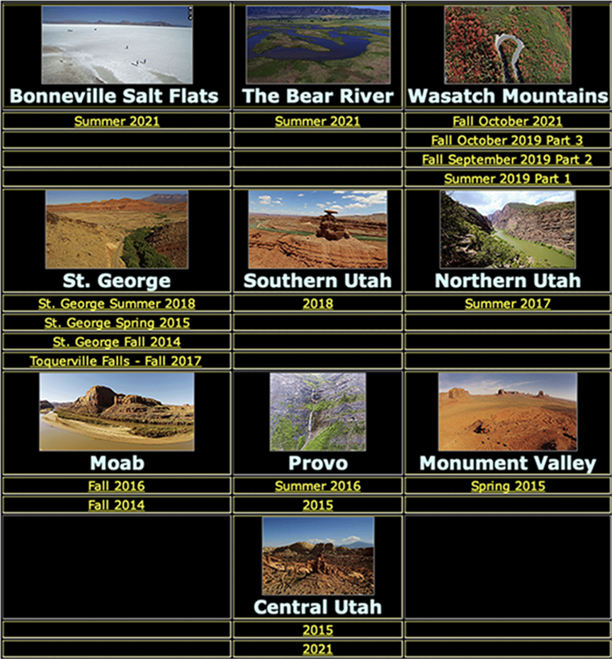
Aches National Park has a multitude of massive sandstone arches ranging in size right up to three hundred feet. Landscape arch (the 300-foot span) is generally considered the longest natural arch in the world. Some formations have multiple arches in a single formation (Double Arch) and the champion of all is the huge arch known as Delicate arch, which sits atop a mountain! |
|
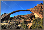
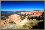
Bryce Canyon in Southern Utah is a twenty-five mile long sheer cliff of sandstone, whose multicolored layers expose millions of years of geologic history. A road connects key overlooks to allow the views below, and what we see from a helicopter is breathtaking. |
|
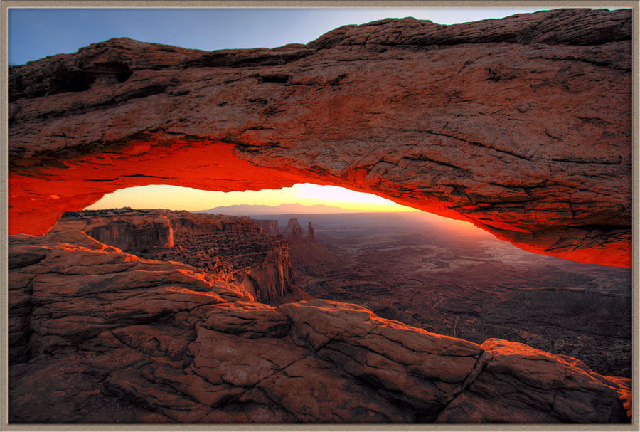
Canyonlands National Park |
|
Capitol Reef National Park |
|
Cedar Breaks National Monument Cedar Breaks National Monument is a park which lies to the West of Bryce Canyon, and is considered a smaller relative to that twenty-five-mile long formation. Cedar Breaks was formed by the same forces which created Bryce, simply on a smaller scale--though it is still a very impressive canyon, exposing millions of years of geologic history. |
|
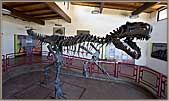
Cleveland Lloyd Dinosaur Quarry This is a working quarry, where paleontologists exhume dinosaur bones and bring them into laboratories for study. The resulting exhibits are then shown in museums around the world. |
|
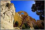
Cottonwood Canyon Road and the Grosvenor Arch Cottonwood Canyon Road runs South from Cannonville (a few miles East of the Bryce Canyon National Park) through the Grand Staircase Escalante and the southern portion of Capitol Reef National Park. |
|
Dinosaur National Monument ~ Vernal, Utah |
|
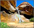
Escalante, Boulder and the Hole in the Rock Trail in Utah The visitor to Escalante and Boulder will be able to access such stunning attractions as Hell’s Backbone Bridge, the Hole in the Rock Trail, the Lower Calf Creek Falls, the Head of the Rocks Vista, The ‘Most Beautiful Road in America’ and other photographic gems. I have put them all in separate galleries for easy access, and hope you enjoy them. |
|
Fantasy Canyon, Uintah County, Utah |
|
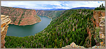
Flaming Gorge National Recreation Area Flaming Gorge National Recreation Area is a federal zone around the flaming Gorge Dam and the 90-mile long reservoir built up behind it. The huge body of water makes its way through deep gorges in the South, then spreads out in rolling hills as it extends into Wyoming at its northern end. Especially in the South, the geology around the reservoir is both varied and dramatic. |
|
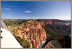
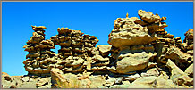
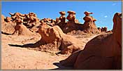
Goblin Valley and Nearby Attractions Goblin Valley State Park, Utah Goblin Valley is a small park, a small valley in which hundreds of sandstone formations have been eroded and weathered until they look like a goblin army marching across the sand. The park has an elevated viewing area to look out across the army of stone figures, and visitors can freely walk down into the valley amid the formations to see them at close range. Little Wild Horse Canyon—Introduction This is one of several famous slot canyons in the southwest. Sunlight reflecting off the complex faces of the walls as it penetrates the slots creates all kinds of color effects. Add to that the scouring action of flash floods polishing and shaping the walls, and we find each section of the canyon a new work of art. |
|
Kodachrome Basin State Park |
|
Kolob Canyons in Zion National Park Kolob Canyons is actually the northernmost corner of Zion National Park. but is far enough away that it has its own entrance and park services. It is an immense valley with a massive cliff of sandstone that extends for miles. Scenic overlooks offer views of tall formations with sheer vertical sides and rich colors of sandstone. |
|
Moab is a small town of about 5,000 (as of the 2000 Census) in East/central Utah, set in some of the West’s most varied and impressive scenery.
|
|
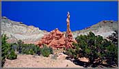
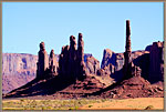
In the southeastern corner of Utah are found a cluster of fascinating parks. The most famous of these is Monument Valley, a colossal span of desert which is filled with many thousand-foot towers of sandstone rising from the valley floor. This valley has formed the scenic backdrop for countless western films because of its breathtaking scope, color and sweep. |
|
Natural Bridges National Monument, the Moki Dugway and Goosenecks State Park When we leave the Valley of the Gods going North, we must get up the huge escarpment which forms a formidable barrier. A switchback road called the Moki Dugway was constructed in 1958; it now offers easy access to the Natural Bridges National Monument. Natural bridges and arches are formed differently. Arches are created by countless cycles of water freezing and thawing in cracks in sandstone mountains. Natural bridges are formed when a winding curve of river (similar to those in the Goosenecks images) breaks through a wall and cuts an entire loop out of the river’s course. In Natural Bridges National Monument there are three such bridges. The most accessible is the Owachomo Bridge, which visitors can easily hike to and enjoy the soaring structure rising above them. |
|
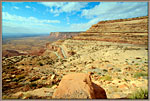
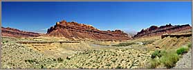
Driving across southern Utah on Route 70 from Las Vegas brings us past several stellar attractions. To the north of the highway about fifty miles is the Cleveland Lloyd Dinosaur Quarry. Not far from the Quarry we drive onto a spectacular overlook above the vast canyon of the San Rafael River known as The Wedge. Utahns call this ‘Utah’s Grand Canyon. Then we cross the enormous anticline formation and cliff known as the San Rafael Swell, a gigantic fold in the Earth’s crust caused by the collision of two tectonic plates. There is along, winding passage down off the highlands through Spotted Wolf Canyon. |
|
Valley of the Gods is a smaller version of Monument Valley whose towers are perhaps 600 feet tall. They stand off the base of a huge escarpment which is a magnificent platform for photography The Valley also has a winding road though it which offers close access to the massive formations. |
|
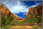
Zion National Park |
Carl Roessler
P.O. Box 33668
Las Vegas, NV 89133
voice: 702.562.0226
fax: 702.562.0227
| Return to Home Page | E-mail Carl Roessler: divxprt@cox.net | Photos |
|---|
All material in this Web Site is Copyright © Carl Roessler
2023 - All rights reserved.
Maintenance by Patricia
of Visual Ad Worx
Modified 11.07.23