Carl's
Gallery of
National Parks
Carl's |
|
National Parks |
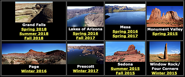
Arizona |
California |
California's East Slope |
Colorado |
Idaho |
Montana |
Nevada |
New Mexico |
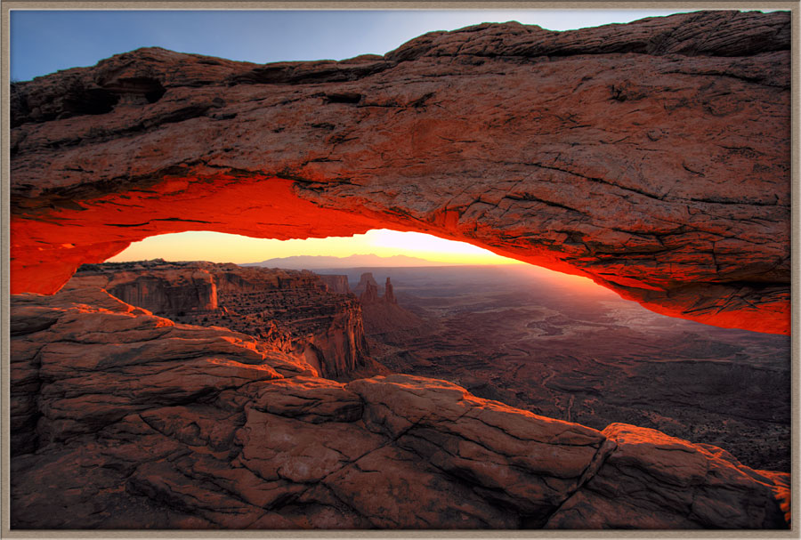
Utah |
Canadian Rockies West |
Canadian Rockies East |
|
Using Drones for Aerial Photography |
||
Please also visit our drone galleries at Arizona Drones
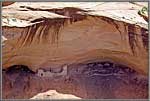
I first heard of Canyon de Chelly from two friends who had enjoyed their own visit there. As I researched the park, it stood out as rather different from others I had photographed. Canyon de Chelly has a natural water supply, offers shelter from the extreme high desert weather. This topography has led to Canyon de Chelly having been occupied for thousands of years by |
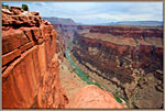
While the South Rim of the Grand Canyon is famous and visited by millions of tourists, the equally spectacular North Rim is unspoiled, lightly visited and a wonderland for photographers. Especially inspiring is the remote location known as Toroweep. A sixty-mile drive on a dirt road takes you to a 3,600-foot high sheer cliff with views of the Colorado River stretching away to both the North and South. |
|
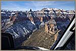
The Grand Canyon is ten to eighteen miles wide as it meanders in a generally East-West direction though northern Arizona. The North Rim, described above, has relatively few visitors, while the South Rim has a well-developed capacity to handle crowds during the warmer months. No matter. When you stand at the rim or fly out over the Canyon, you are awed by its majesty of the topography and can find numerous overlooks where you are essentially alone with the view. I was fortunate to take two of these flights a few months apart—hence the snow in some pictures and Summer-like colors in others. |
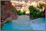
One of the most remote of all these adventures takes us to Arizona, along the South Rim of the Grand Canyon. There, is a side canyon, the Havasupai Indian tribe have lived along a river punctuated by mighty waterfalls--the 100-foot-high Havasu Falls, the 200-foot-high Mooney Falls and smaller falls to the North and South. To reach these falls requires a ten-mile hike from the crest of the Grand Canyon--or a helicopter flight and a two mile hike! The experience is worth every step, because these falls are both magnificent and unforgettable. |
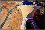
Hoover Dam is an engineering marvel, built at great sacrifice in the Great Depression. See my YouTube video Hoover Dam is an engineering marvel, built at great sacrifice in the Great Depression. See my YouTube video |
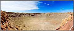
Meteor Crater
On the long drive from Las Vegas to Monument Valley, we pass the town of Winslow, site of an historic meteor impact. While the site has but one attraction, it has an excellent park with extended pathways to allow viewing the crater from different angles. The crater does get one’s attention. You would not want to be anywhere in the state when one of these impacted! that this is a special gem of the National Park System. |
Page, Arizona and the Glen Canyon Dam Page is a small town at the East End of the Paria Plateau. It was built during the construction of the enormous Glen Canyon Dam, which lies just outside town. A few miles south is the colossal bend in the Colorado River known as Horseshoe Bend, and even further South lie the Vermillion Cliffs, which are on the southwest corner of the Paria Plateau. Page is also famed for Antelope Canyon, one of a number of slot canyons found near Page and Kanab, Utah. |
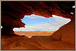
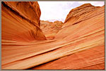
The Paria Plateau is a large elevated plateau between Kanab, Utah and Page, Arizona. Dramatic formations such as White Pockets, where the sandstone looks like sea foam, or South Coyote Buttes with its enormous cliffs and buttes, impress even seasoned travelers. The star of the show, however, is The Wave, an elevated valley in which the sandstone formations look like striped candy or ice cream, swirled into graceful whorls. |
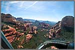
Sedona is another magnificent place which was recommended to me by a friend. Unlike all the other parks in this collection, Sedona is a settled community rather than an area reserved as a park. |
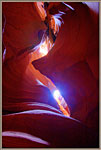
Slot Canyons in Page, Arizona and Kanab, Utah Slot canyons are narrow and uneven cracks in the great sandstone buttes. Their tops are open to the sky, allowing sunlight to wash down the twisting walls. The light reflecting repeatedly creates amazing effects when photographed--which has made certain slot canyons such as Antelope Canyon famous around the world. |
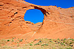
Window Rock, Hope Arch & Los Gigantes Window Rock Chinle and Hope Arch Chinle, on the eastern border of Arizona, is the home of the western entrance to Canyon de Chelly National Park, covered in its own gallery. Round Rock and Los Gigantes |
Carl Roessler
P.O. Box 33668
Las Vegas, NV 89133
voice: 702.562.0226
| Return to Home Page | E-mail Carl Roessler: divxprt@cox.net | Photos |
|---|
All material in this Web Site is Copyright © Carl Roessler
2025 - All rights reserved.
Maintenance by Patricia
of Visual Ad Worx
Modified 01.09.25